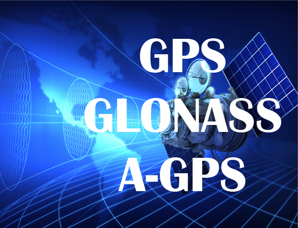

Many of us are familiar with the Global Position System (GPS) function on your mobile phone, often using it for your Facebook check-ins, Google maps, RunKeeper, EveryTrail and all things location-‘o’-goodness . Do you know what this location technology called GPS is all about, and for that matter, what is GLONASS that you see in the new smartphone that you might currently be eyeing on? And how about A-GPS or aGPS, just to throw in these two terms that you might possibly see on the brochure too?

Global Position System (GPS)
The GPS, made fully operational in 1995, is a space-based satellite navigation system that provides location and time information in all weather conditions, anywhere on or near the Earth. The system provides critical capabilities to military, civil and commercial users around the world. It is maintained by the United States government and is freely accessible to anyone with a GPS receiver. Orbiting at an altitude of approximately 20,200 km (12,600 mi) twice a day are 32 satellites in the GPS. With an original of 24 satellites, the additional 8 satellites improve the precision of GPS receiver calculations by providing redundant measurements. From year 2000, the precision of the GPS signals were improved from 100m to 20m for civilian use. In general, GPS navigation can reach an accuracy of between 2.00 to 8.76 metres.
Global Navigation Satellite System (GLONASS)
GLONASS (Russian: ГЛОНАСС, IPA: [ɡlɐˈnas]; Глобальная навигационная спутниковая система), acronym for “Globalnaya navigatsionnaya sputnikovaya sistema” or “Global Navigation Satellite System”, is a space-based satellite navigation system operated by the Russian Aerospace Defence Forces. It provides an alternative to Global Positioning System (GPS) and is the only alternative navigational system in operation with global coverage and of comparable precision. Completed in Dec 1995, the GLONASS started with 24 satellites. The satellites are located in middle circular orbit at 19,100 km altitude (slightly lower than GPS’ satellites). After a period of disrepair, the full orbital constellation of 24 satellites was restored, enabling full global coverage in October 2011. Since 2007, the military-only signal with a precision of 10 m has been made freely available to civilian users. There are currently 32 satellites in the GLONASS constellation. In general, GLONASS navigation can reach an accuracy of between 4.46—7.38 metres. The first iPhone to support GLONASS technology was the iPhone 4S.
| GPS | GLONASS | |
| Ownership | United States | Russia |
| Coverage | Worldwide (Generally a Good Option Globally) |
Worldwide (Good at Higher Latitudes) |
| Satellites | 32 | 32 |
| Orbit Height | 20,200 km | 19,100 km |
| Precision | 2.00 to 8.76 metres | 4.46 to 7.38 metres |
| You see (at any one location) | 8 to 12 satellites | 6 to 10 satellites |
For GPS or GLONASS to work, there must be unobstructed line of sight to 4 or more satellites. Some of the mobile phones support both GPS and GLONASS. For example, if you have a snapdragon chipset on your mobile phone, you will be able to use both constellations of satellites to help you determine your location. What this means is that your smartphone will receive greatly improved coverage in urban canyons (i.e. limited “view” of the sky) and achieve a very fast time to fix due to over 50 satellites (combining GPS and GLONASS satellites) being available. In indoor, urban canyon or mountainous areas, accuracy can be greatly improved over using GPS alone (which are used by the lower end smartphones). When both navigation systems were used simultaneously, the precisions of GLONASS & GPS navigation can reach between 2.37—4.65 metres.
Therefore, if you plan to leverage positioning technology for your hiking or driving, it would be better to get a smartphone with support for both GPS and GLONASS, so that you can enjoy twice the number of satellites for your location needs. To test your GPS on an Android phone, you could download the “GPS Test” application from https://play.google.com/store/apps/details?id=com.chartcross.gpstest . On the screen you will see that there are different signal levels used to calculate the current location of the smartphone. The numbers in Inverted grey boxes are the GLONASS satellites that your smartphone is able to “see” in the sky:
 A-GPS / aGPS
Assisted GPS (abbreviated generally as A-GPS and less commonly as aGPS) is a system that can in many cases greatly improve the startup performance or time-to-first-fix (TTFF) of a GPS-capable cellular smart-phone by leveraging on the telecommunication mobile network station to get data and assistance in obtaining the positioning fix more quickly. Hence, with A-GPS + GPS + GLONASS, getting a quick fix on your current location will be a breeze, with acquisition time that can hit the regions of seconds instead of minutes! Since we are at this, the following video would also provide you with a quick narrative video about the GPS and GLONASS feature onboard the Snapdragon chips found in many smartphones today.